
Walk a Hamilton County Street
For a named Hamilton County street, begin with the address form the county uses. The result is a parcel trail, not a household roll. It can identify the site address, parcel identifier, current owner and tax-mail labels, transfer data, and a legal-description fragment. Each label has a limited meaning. An owner or tax-bill addressee may be elsewhere, while a historical directory can show only the person printed for its year. The practical sequence is address, owner record, deed, voter geography, then an address-first historical directory.
- Enter the address in the Hamilton County Auditor Property Search. For one property, put the number in House # Exact/Low and leave House # High blank. For a segment, use low and high numbers with the street name written without its suffix.
- Open the parcel summary and record the parcel ID, situs address, owner or tax-mail label, transfer details, and legal description. The usual parcel number has 13 characters. These fields anchor the next search, but do not establish that the named owner lives at the situs.
- Use the Transfer view and the parcel or owner information to reach Recorder instruments. Read the party roles, prior-instrument reference, book/page, and legal description before taking the chain backward.
- Use the Hamilton County Board of Elections public list tools and CAGIS precinct context only within their published categories. They provide voter-list and geography routes, not a claim that every person on a street is registered or publicly listed.
- For an earlier address, consult the Cincinnati & Hamilton County Public Library's Pink Pages and Criss-Cross volumes. Those address-first listings can supply a historical printed name to compare against the deed and transfer dates.
Keep a short, dated research note as the search moves through these systems. Record the successful street spelling, directional prefix, municipality, parcel, transfer date, and directory year. That prevents a current parcel label from being merged with an old directory listing.
Search Hamilton County Street Ranges
The Auditor's Street Address route is the countywide entry point for a stretch of road. It accepts House # Exact/Low, an optional House # High, and Street Name. The street name is entered without ST, DR, CT, or another suffix. Street Listings helps confirm how the system stores a name. An exact number belongs in Exact/Low with the high field empty; a low and high number return parcels across the requested segment. A house number without a street can return matching numbers on different roads, so it is a poor substitute for the street field.
| Auditor field | Use for a street search | Format or limit |
|---|---|---|
| Search method | Choose Street Address | Owner, Parcel ID, Sales, and Advanced are separate routes. |
| House # Exact/Low | One address or the first address in a segment | Leave House # High empty for an exact lookup. |
| House # High | Last address in a segment | Optional range endpoint. |
| Street Name | Street discovery and range search | Enter no suffix; Street Listings checks spelling. |
| Parcel Number | Return to a known property | Full or partial number accepted; most values have 13 characters. |
Results stop at the first 1,000 records, so a long Hamilton County street should be divided into smaller ranges or narrowed with another documented property field. The limit is a reason to refine the request, not evidence that a road has no additional parcels.
Note: Results are parcel records, so the visible owner and mailing fields should remain distinct from any conclusion about current occupants.
Read Hamilton County Street Parcels
A property summary separates the current physical location from mailing and title information. It can display a site address, current owner name and address, a separately labeled Tax Bill Mail Address, tax district, school district, assessment figures, sales or conveyance fields, and a legal or property description. It also links to transfer history, value history, payment details, maps, imagery, and related owner names. Those links make the Auditor record a useful bridge, but its role is still a property and tax record.
- Parcel
- A county property identifier. Hamilton County parcel values are normally 13 characters, and the number bridges street discovery to recorder and map records.
- Situs address
- The physical address of the parcel. It is different from the address used to mail a tax bill.
- Legal description
- The lot, subdivision, plat, or metes-and-bounds identity used in a deed. It can remain useful when street wording changes.
- Criss-Cross directory
- An address-first printed directory. It can show a historical listed name, rather than a complete modern household.
The County's transfer standards require a grantee tax mailing address as well as property address information. Treat a mailing address as a notice destination. It is not proof that its recipient occupies the parcel. The separate Owner Occupancy Credit and Homestead fields are also tax-program fields, not a roster of everyone at an address.
Map Hamilton County Street Parcels
CAGIS Online adds the map relationship that a result list cannot show. Use Quick Find with Address or Parcel ID, select the subject property, and use the property-data route to open its Auditor report. County instructions also describe changing Quick Find to Tax Maps, entering Book-Page-Parcel, and selecting Show Parcel Data. Map Layers can display Voting Districts, which helps separate precinct geography from a street or postal label.
CAGIS parcel polygons are updated monthly, while aerial boundary lines are approximate. A map click is therefore a navigation tool rather than survey proof or a title opinion. For a nearby-record check, the Auditor Advanced search offers Origin Property Key and Feet from Origin, returning records within the stated distance of an origin key. Constrain the distance and compare the property report for each returned parcel.
Trace Hamilton County Street Deeds
The Recorder does not use a street address as its main key. After the Auditor establishes the parcel, current owner, transfer information, and legal description, move to Recorder Acclaim. Acclaim offers Name, Record Date, Date Range/Document Type, Book/Page, Document #, Subdivision/Lot, Section/Town/Range, Auditor #, Subdivision Name, and Certificate # routes. The Auditor number, legal description, or party name turns a street result into a document search.
Acclaim's Auditor-number search is the direct parcel route shown below. Capture the document number, date, party role, prior reference, and book/page when available. The instrument can then send the search backward through the seller as an earlier grantee, or forward through a buyer. The legal description matters because a street address is not the Recorder's primary indexing language.
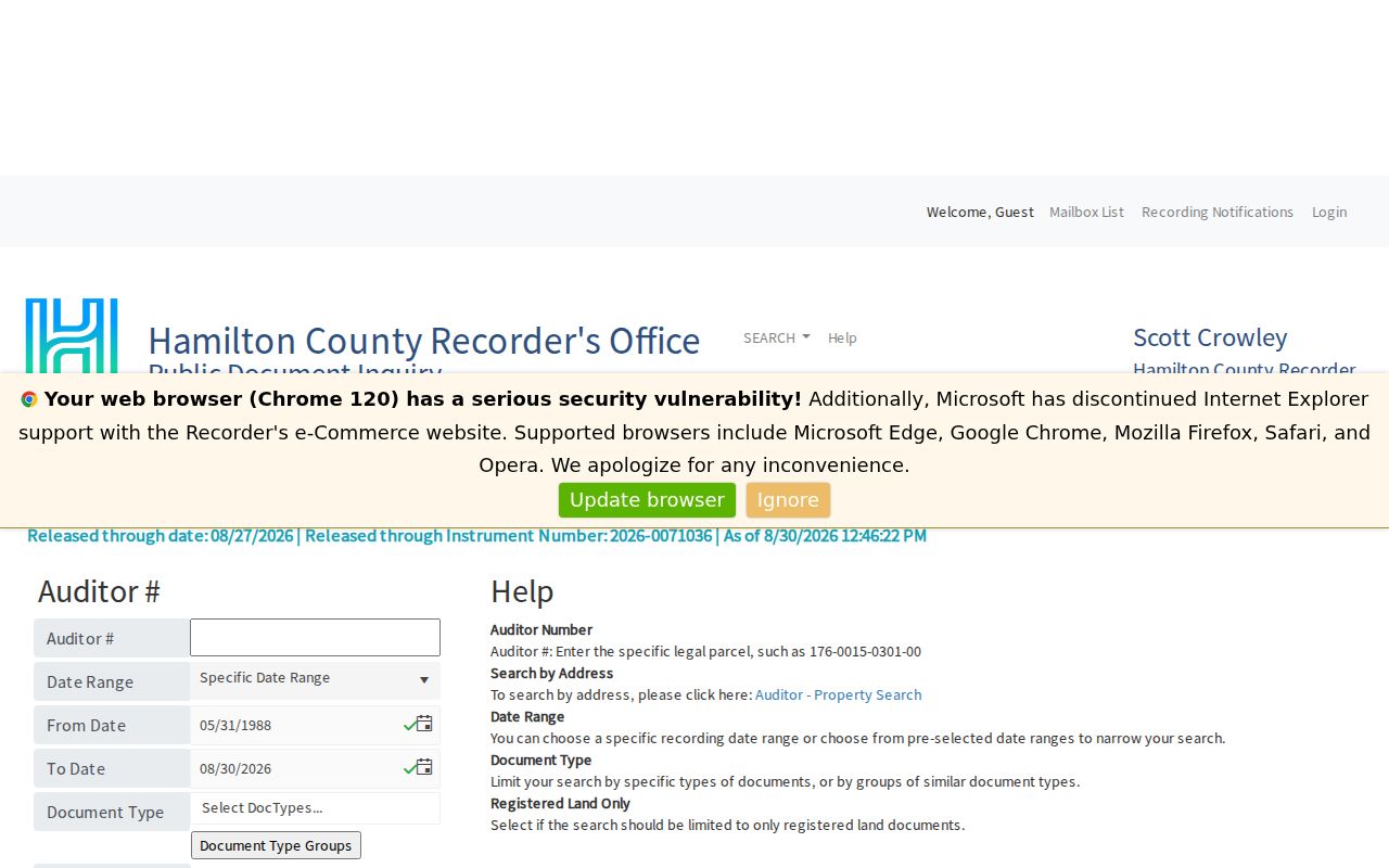
The parcel route supports a reproducible handoff from an address search to a recorded-document search. Compare each document date and party role with the Auditor transfer record before carrying a name or address into another period.
Note: A January 1 transfer date can be a filler date; the Ownership Card may provide an older actual date.
Hamilton County Street Deed Tip
Most documents from 1988 forward can be approached through Acclaim's name search. Older work needs the Recorder's historic Grantor & Grantee Deed Indexes for 1914 through 1988. Grantor-to-grantee runs seller to buyer; grantee-to-grantor runs buyer to seller. Select the year and first letter, record the book and page, then use Acclaim's Book/Page route. Some digitized pages can be offset by one or two pages, so use the page arrows rather than treating the first image position as conclusive.
The Recorder says its online document indexes extend from 1789 to the present, while search functions, scans, and images have different coverage. Its historic search materials also include the 1913 Cincinnati Street Index. That is an address-history aid, not a replacement for checking the deed's legal description.
Hamilton County Street Record Layers
A Hamilton County street directory question often crosses several keepers. Each source has a distinct role and access limit. Use the parcel number and legal description as the stable links when a road has been renamed, a property has changed configuration, or a current mailing label differs from the site address.
| Address-linked record | Keeper | What it can show | Access boundary |
|---|---|---|---|
| Property search | Hamilton County Auditor | Parcel, situs, owner or tax-mail labels, transfers, values | Free; street ranges work, with a 1,000-result cap. |
| Parcel map | CAGIS | Parcel geometry, map context, tax-map and precinct layers | Free map; displayed boundaries are approximate. |
| Recorded instruments | Hamilton County Recorder | Deeds, party roles, legal descriptions, book/page, Auditor number | Free online index and images; historic route is needed before mid-1988. |
| Foreclosure parcel search | Clerk of Courts | Parcel or address information in foreclosure cases | Free but foreclosure-only; earlier cases can lack parcel data. |
| Printed directories | CHPL | Historical name-to-address and address-to-listing context | Not a complete current occupancy record. |
The Clerk's foreclosure parcel and street search is a separate, limited court route. It accepts a parcel ID or street address and is not an all-purpose deed or resident search. For street searches, its form accepts an exact number, optional direction, and a street name without ST, DR, or AVE; cases before June 1, 2013 may not contain parcel data.
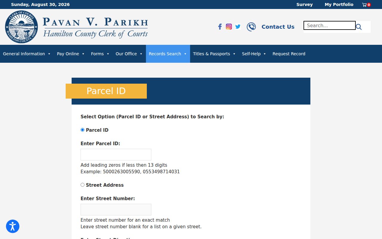
This Clerk form belongs in a foreclosure-case check after the parcel is known. It does not expand the Recorder's document index or establish a general list of people at an address.
Cincinnati Address Permit Records
For a property inside the City of Cincinnati, the public Accela property lookup has Address, Parcel Information, Owner, and Record Information modes. Its address form captures low and high street number, direction, street name, street type, unit number and type, city, state, ZIP, census block group, census tract, and 2020 census block. The fields help find municipal permit or property records, not a countywide resident list.
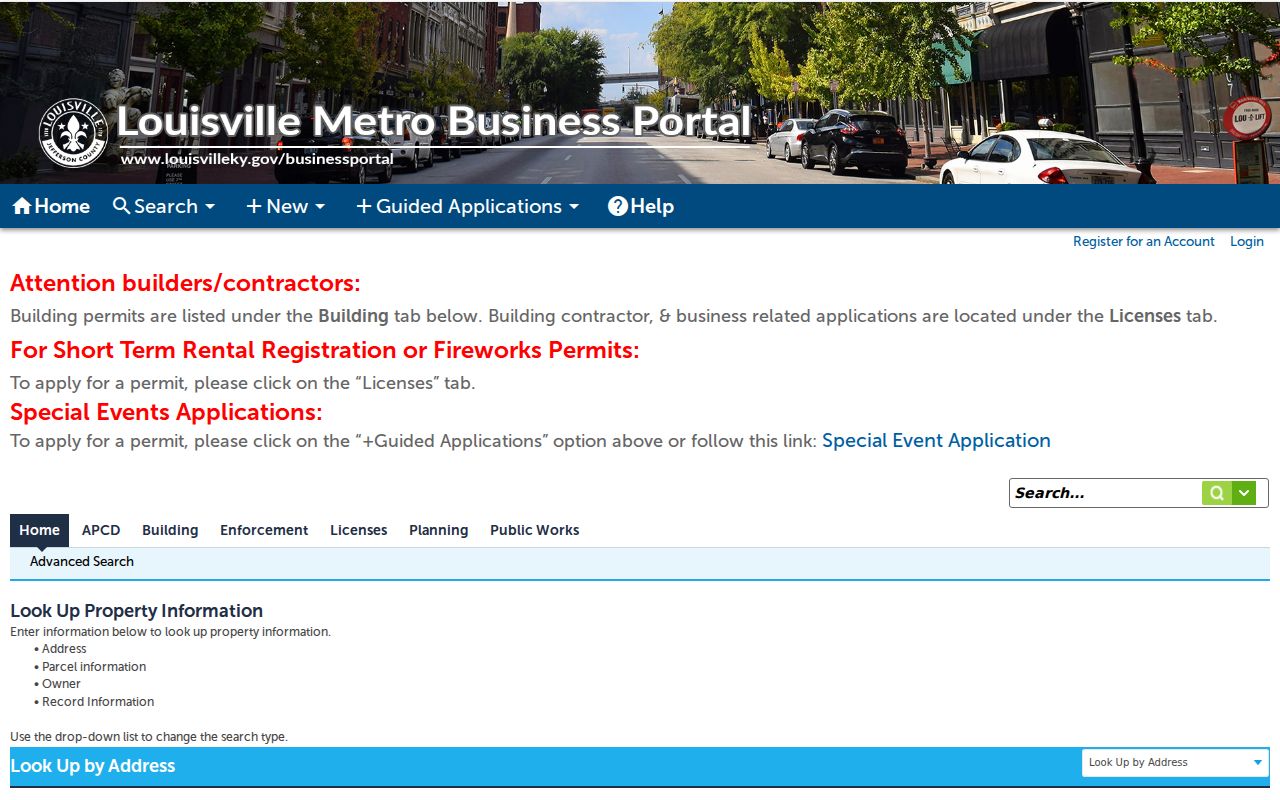
Use the exact number, direction, and suffix fields when a Cincinnati address needs to be separated from another similarly named street. Check the Auditor tax district and CAGIS context first because Hamilton County includes other cities and townships with different custodians.
CAGIS Activity Report, also called ezTrak, is another Cincinnati-only layer. The City guide describes an address search that can show an inspection timeline, inspector notes, past or current violations, and order status.
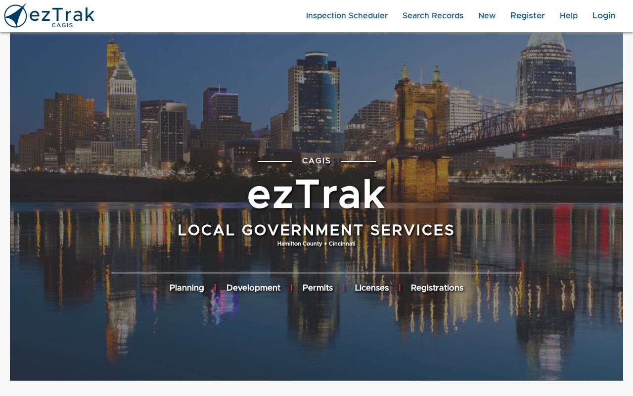
A missing Accela or ezTrak result outside Cincinnati is not evidence that a permit or code record does not exist. It can simply mean another municipality or township holds the relevant municipal record.
Bridge Old Cincinnati Street Numbers
Most Cincinnati street addresses changed in 1895. That break makes a simple old-to-new number match unreliable. The Cincinnati & Hamilton County Public Library recommends the 1891 Sanborn fire-insurance maps to find older numbers and addresses. Maps from 1904 onward use the new numbers and show building outlines and material colors. The Recorder's historic search also offers a 1913 Cincinnati Street Index.
Before attaching a pre-1895 listing to a modern parcel, compare the period map or street index with the legal description. The 1883 and 1884 Cincinnati Robinson Atlas can add core-city building and old-address context. This extra step protects against creating a false continuous history from two different numbered locations.
Note: Street wording, municipal context, and a parcel's legal description can be more reliable than a bare historical house number.
Use Hamilton County Street Criss-Cross
Historical address-first research belongs with CHPL's directory collection, rather than the current Auditor record. Cincinnati directories reach back to 1819. Pink Pages begin in 1925 and list addresses in street order; the collection became the Criss-Cross Directory in 1941. An address can therefore lead to a printed name for a particular directory year, then to ordinary directories, census material, newspapers, or probate records for corroboration.
The CHPL house-history guidance connects deeds, directories, census sources, historic maps, and local indexes. For fuller directory collection details, use the Hamilton County City Directories page. A directory entry must stay tied to its publication year because inclusion, abbreviations, and address coverage vary.
Hamilton County Street Search Myth
A common mistake is treating an ownership, tax-mail, or postal field as proof of occupancy. Hamilton County property cards intentionally label owner name and address, tax-bill mail address, and situs address separately. The Ohio voter lookup is an individual registration-status tool, and Board of Elections list products use defined public categories. Utility and delivery lists, nonpublic driving-record information, protected voter locations, sealed court files, and unrecorded household details are not a street directory.
The useful result is a dated chain of public record roles: a mapped parcel, physical situs, owner or tax-mail label, transfer or document party, precinct geography, and historical directory listing. It is more accurate to state which role each source supports than to collapse them into a claim about every person on a street.
Lawful use. Hamilton County street and address records support personal, lawful research. Do not use a record trail to stalk, harass, intimidate, or harm anyone.